Vikas Koli’s wooden vessel winds through Mumbai’s mazes and creeks, while he watches intently at his smartphone’s map.
India’s financial capital, the city is home to more than 20 million people. Concrete slabs rise up from land reclaimed form the creek to make a boat dock for commuters. A block of high-rises can be seen upstream.
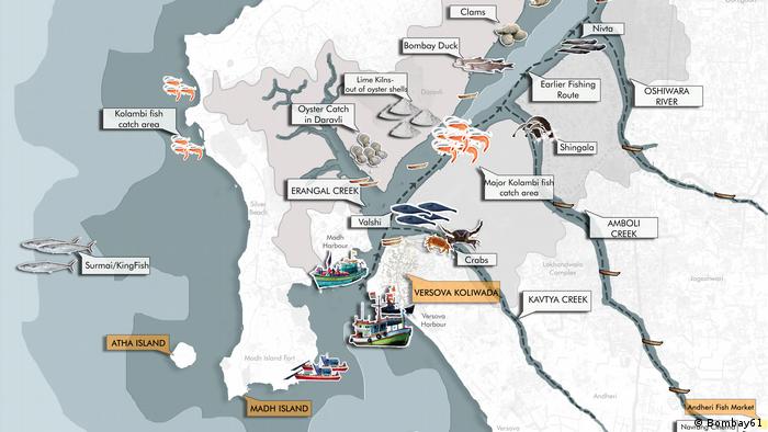
The map does not show Mumbai’s modern landmarks. Instead, the map shows only one of the many creeks that divide Mumbai. It also shows a simple illustration showing a fishing boat with two crabs.
Vikas sees the map as a way to tell the story of a forgotten past. Bombay61 urban design studio and think tank created it. It locates points along old fishing villages (or ‘koliwadas), which were important sources to fish and crab prior to the city’s expansion.
Redefining development
Bombay61 hopes the maps will encourage nostalgia and a greater appreciation of the environment among locals like Vikas. Their efforts to bring to the forefront livelihoods, natural systems and other aspects are part of a wider movement that includes climate activists and urban designers who look back at Mumbai’s history for an alternative vision.
“The water quality was good, some 20 or 30 years ago, and they used to get some fish over here,” Vikas remembers, pointing at the crab on the map and the corresponding spot on the riverbank.
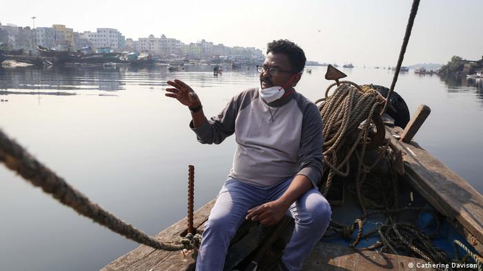
Vikas Koli illustrates how untreated water and pollution can lead to decreased crab catches, and loss of livelihoods
Koli is believed to be one the first inhabitants of Mumbai. They were fishermen and have a close relationship with mangrove forests and creeks.
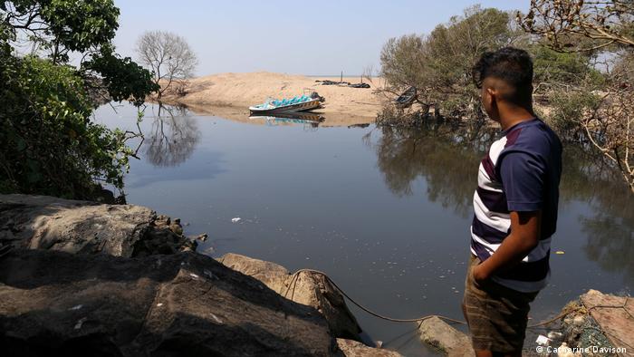
In recent years, however, plastic and effluent have polluted the water, causing damage to mangroves as well as the ecosystems that depend on them. The catch has decreased. “Mumbai used a place where fishermen owned it. But now fishermen are getting displaced,” laments Vikas. “This is the saddest tale of Bombay.”
The city is saved from the sea
Mumbai was originally made up of a series islands. The British colonial era saw the land being reclaimed from the sea. As the population grew rapidly, there was a lot of competition for space. This led to development projects that focused on increasing infrastructure density and housing density.
These have often been atthe expense of natural ecosystems that threaten the survivalof the city. Mumbai floods each year due to heavy monsoon rainfalls. Percolation is impeded by dense concrete construction. Property developers’ encroachments onto floodplains and mangrove forest land have also caused damage to the city’s natural barriers against storm surges.
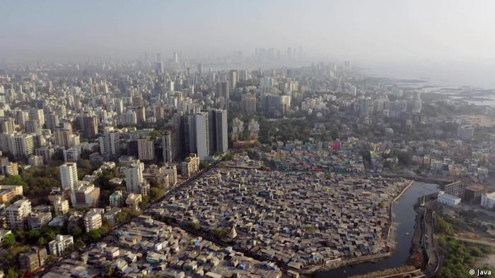
Mumbai’s transformation from a small city to a major metropolis has been a huge success, but it has had to pay the price of its safety from unpredictable nature forces.
These problems are likely to be exacerbated due to climate change. Other major coastal cities, such as New Orleans, Bangkok, Jakarta, and Jakarta, could be inundated by sea levels that rise more than a meter by the end of this century.According to a 2019 study from the Intergovernmental Panel on Climate Change (IPCC). Iqbal Singh Chahal, Mumbai’s Municipal Commissioner Recently warned that if nothing changes, a large portion of the city would be underwater by 2050.
Place memories on the map
For Bombay61 co-founder Ketaki Tare, looking to the past is key to facing up to the future.
Tare and JaiBhadgaonkar were co-founders of Mapmaker. They hoped that by recording the community’s memories in maps, they could help reverse what American psychologist Peter Kahn called “The American Psychological Syndrome.” “Environmental generational forgetfulness” where young people normalize their pollutedenvironment.If concrete development, pollution and annual floods become “the new normal,” explains Tare, it is difficult to envision an alternative.
The murals are also depicting scenes from local stories. There is also a photo archive that shows what the creeks and coast looked like in the past.
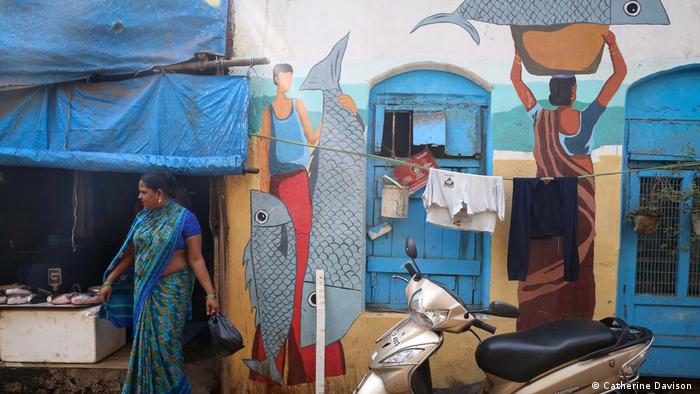
A Bombay61 mural illustrating the historical importance Versova koliwada’s role as a fish trading marketplace
Debi Goenka is executive trustee of the non profit Conservation Activist Trust and agrees that there is a need to find a new approach. “The bottom line is that any project that destroys your natural infrastructure to replace it with artificial infrastructure, in my mind, is not developing,” he says.
Protecting mangrove forests
This tension in urban development is reflected in the way mangrove forests are managed. Goenka has been advocating for policies that prohibit the development of mangrove forests and floodplains in the city for years. Between 1990 and 2001, almost 40% of Mumbai’s mangrove forests were destroyed. According to one estimate.
The Mangrove Cell was established in 2012 after increasing public pressure on the state government. The Mangrove Cell, India’s first government agency, was created in 2012 after increasing public pressure on the state.
“Land is a major concern in a big city like Mumbai. So, there were initially a lot of problems,” says Dr Sheetal Pachpande, ecologist and deputy director of projects at the Mangrove Foundation, a subsidiary of the government department.
She claims that “today, 99%” of encroachments have been stopped by a combination of chain link fences and trenches to protect the land, dedicated forest rangers, outreach, education, and dedicated forest rangers. [on mangrove forests]Mumbai was removed.
They also claim to have planted over 8,000,000 mangrove saplings.
Community action and ownership
Goenka believes however that such efforts are only possible if there is public participation, which Bombay61 refers to as “participationasa mode of development.” By incorporating memory into urban design, their projects aim to help the Koli revive a sense of ownership over their surrounding environment motivating them to protect it.
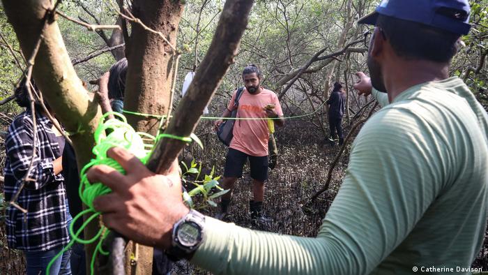
Future projects include mangrove tours to increase public awareness about their benefits and a scheme to assist the Koli in collecting plastic waste in nets strung along the creeks.
Tare explains that Koli will be in a position to simultaneously generate incomes and protect their environment. Vikas is currently running tours through Koliwada showing visitors the creeks, wall murals, and campaigning for the preservation.
“They know the mangroves verywell,they know the species also,” explains Tare. “Why can’t these communities be considered guardians for these natural resources?”

